When I moved to San Leon in 1975, the Southern Pacific Railroad still ran freight trains along the line from Galveston past San and Leon and up through Kemah, Freeport, and beyond. The track was four miles away from the the house, but at night, the sound of the whistles, the rumble of the big diesel electric locomotives, and the rattling freight cars were so loud they could drown out the TV in the evening.
Sometime in the 1990's, the railroad bridge between Kemah and Seabrook was removed, cutting the line. I didn't notice the trains were gone for a long time, until one day I realized I had not seen any traffic along the line for over a year. The Southern Pacific Announced in October 1995 that they were abandoning the line between Seabrook and San Leon as part of the merger with Union Pacific.
I began my exploration of the NGH&KC RR line near Dickinson Bayou.
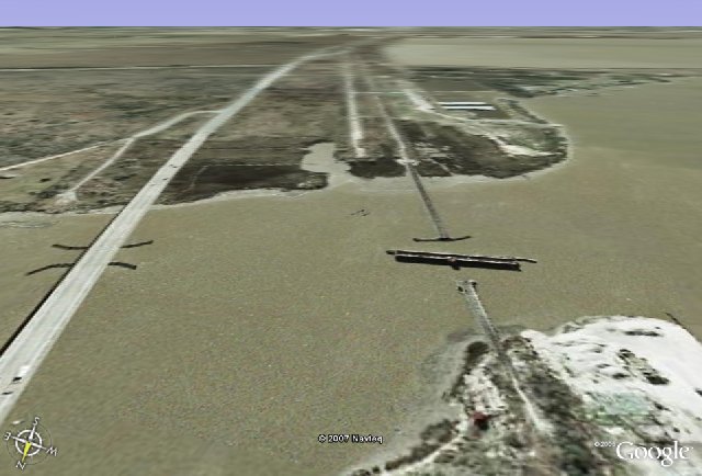
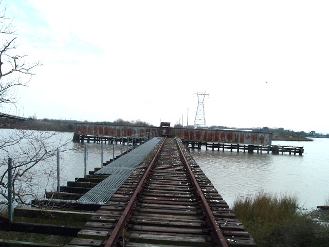
The abandoned railroad line crosses Dickinson Bayou on a swing bridge which is still rusting slowly in place, as shown in this image from Google Earth. Across the bayou, you can see the track of the old Highway 146 where it continues south toward Galveston. On the left is the high bridge which replaced the old highway draw bridge that once stood next to the railroad swing bridge.
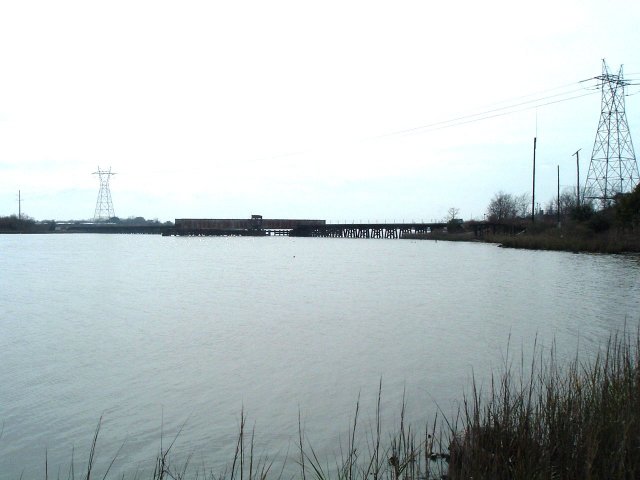
I parked my pickup in the parking area of the boat launching ramp which lies under the north end of the high bridge over Dickinson Bayou and took this long range shot of the railroad swing bridge.
I wanted to get some close up shots of the bridge, so I went looking for the railroad tracks, but first I hid in my pickup truck while a rather large, hungry looking dog walked across the parking lot. It was a cowardly thing to do, but so what, nobody will ever know but you and me.
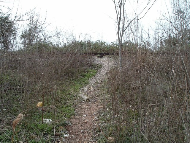
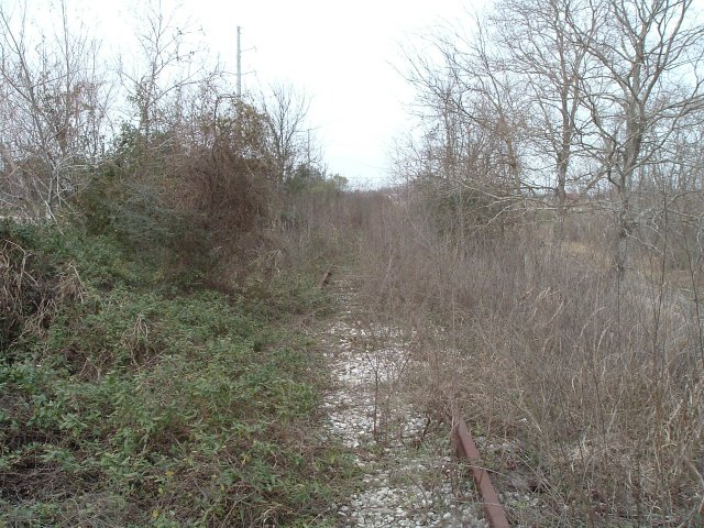
The closer I came to the railroad bridgehead, the more overgrown the tracks became.
Finally, there it was in front of me, a grand old lady from railroading history.
According to this geodetic survey map, the San Leon Depot once stood not far from the railroad bridge.
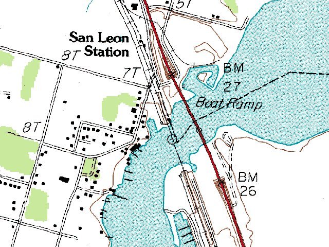
This image includes what must have been the original site of the depot. The track curves slightly to the left in the distance, which agrees with the right of way drawn on the geodetic survey map.
According to a historical note I found on a web-site, the San Leon Depot building was moved to Clear Lake Shores and converted into a residence.
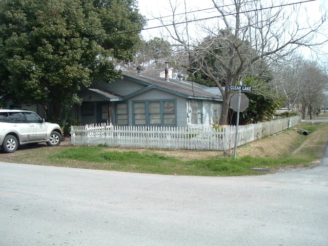
I went to the address, 631 Clear Lake Road, and took this picture of the building that stood there. Presumably, this is what the San Leon Depot looks like today.

This is the best photograph I have been able to find of the San Leon Depot in its heydey, about 1924. This picture was published in the Galveston Daily News January 13 2007.
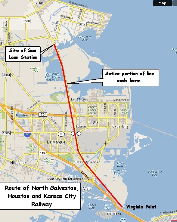
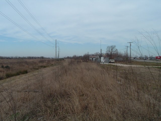
Later, I followed the abandoned railroad north to Kemah and south to where the adtive portion of the railroad begins. We shall save that report for another day.